Peru · Travel guide
Trip to Nazca Lines: Fly, Climb the Tower or Both?

Trip to Nazca Lines planning: the flight against the two official viewpoints, and how we fit Nazca into a calm route south from Lima.
This is the reasoning we use when we date a trip, not an article written to fill a blog. The Peru itineraries it feeds are here.

A trip to Nazca Lines country, in the desert south of Lima, comes down to one decision: whether to see the figures from a light aircraft or from the ground. The flight shows you the most. The two official viewpoints show you less, cost little and keep you on the ground, which after the crash of 1 August 2026 is a choice some travellers want to have.
This guide sets out both, what is known about that accident, and how we route Nazca so that it is not a twelve-hour day from Lima. Figures come from Peru’s national tourism inventory, PromPerú, the Ministry of Culture and the Ministry of Transport, linked where we use them.
What you are going to see
The Lines and Geoglyphs of Nasca and Palpa were inscribed by UNESCO in 1994. According to Peru’s national tourism inventory, they lie between km 419 and km 443 of the Pan-American Highway, and the largest figures are a bird of almost 300 m and a lizard of 180 m, which the highway cut in two when it was built.
The flight or the viewpoints
| Light aircraft | Ministry of Culture tower | Mirador Natural | |
|---|---|---|---|
| Where | María Reiche aerodrome, 3 km from Nasca | Beside the Pan-American Highway | A rocky hill at km 426.4 |
| What you see | The main figures | The Hands and the Tree | Converging straight lines |
| Time | About 55 min for the listed circuit | A short stop on the drive | A short stop on the drive |
| Hours | Flights stop when the weather is bad | Open 8:00 to 17:30 | Not published |
The flight leaves from the María Reiche aerodrome, reached from km 451 of the highway. The tourism inventory lists the circuit at 55 minutes and notes that flights are suspended when the weather is bad. In that 2022 listing, the airport tax was S/ 30 and the air circuit fee S/ 47, on top of the price of the flight. Fees change, so we confirm them before every booking.
The tower is 13 m high and open from 8:00 to 17:30, according to PromPerú. From the top you can clearly see two of the figures, the Hands and the Tree, as Andina, the state news agency, describes.
The Mirador Natural is the viewpoint few people know. It is a rocky hill at km 426.4 with lines converging below it, and while the Ministry of Culture was remodelling its path in 2020 a 37 m feline geoglyph was found on its slope.
The crash of 1 August 2026
On 1 August 2026 a Cessna C-208 that had taken off from Pisco crashed near Nasca, and 13 people died, according to El Peruano, the official gazette. This is what the authorities have said since:
- The Ministry of Transport reported that the civil aviation directorate suspended the operator, Aerodiana, as a preventive measure. The suspension applied to that company, not to all overflights.
- The cause is investigated by the accident commission, the CIAA. The ministry said no conclusions could be drawn yet. We had not found its preliminary report published by 20 October 2026.
- Spain’s foreign ministry, in its travel advice for Peru updated on 28 August 2026, advises against overflights of the Nazca Lines.
We do not have more than that, and we will not write more than that. If you are unsure about flying, the two viewpoints let you see part of the figures from the ground.
Getting there from Lima
PromPerú puts Lima to Ica at about four hours by road and Ica to Nasca at about two more, a little more than six hours in total. Most tours sold online do it as a single day there and back. We split it along the coast, which turns the drive into the trip:
| Night | Where | What you do |
|---|---|---|
| 1 | Paracas | Drive from Lima, 259 km and about three and a half hours |
| 2 | Huacachina | Morning boat to the Ballestas Islands, then on to the dunes |
| 3 | Nazca or onward | The flight or the viewpoints, then south or back to Lima |
Paracas is 259 km from Lima, about three and a half hours by road according to the park service, and its boat trip passes colonies of sea lions, boobies and penguins on the Ballestas Islands. The oasis of Huacachina is 5 km from the city of Ica, ringed by dunes, with sandboarding listed as its official activity.
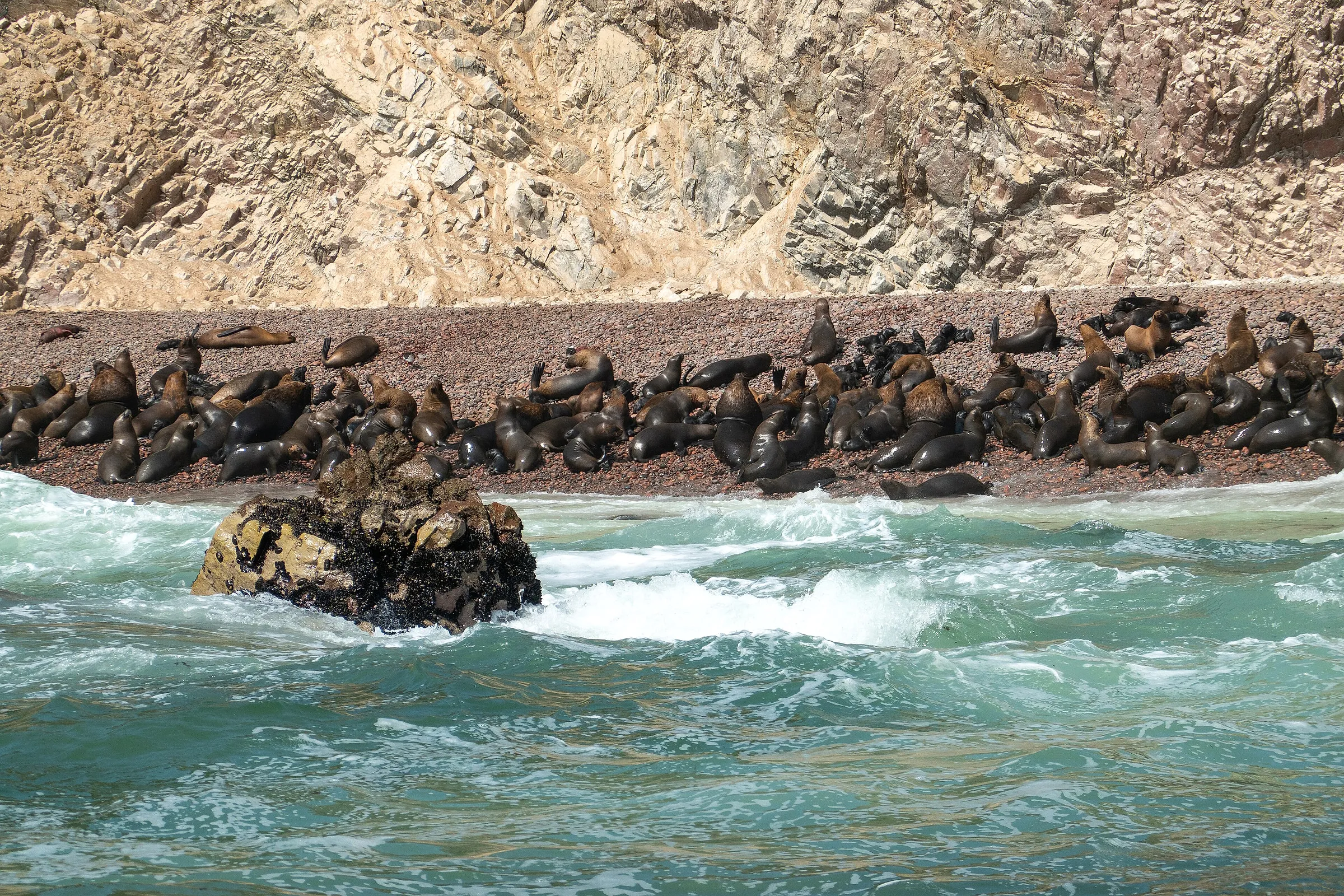
Sea lions on the Ballestas Islands, Paracas. Photo by PsamatheM, CC BY-SA 4.0, via Wikimedia Commons.
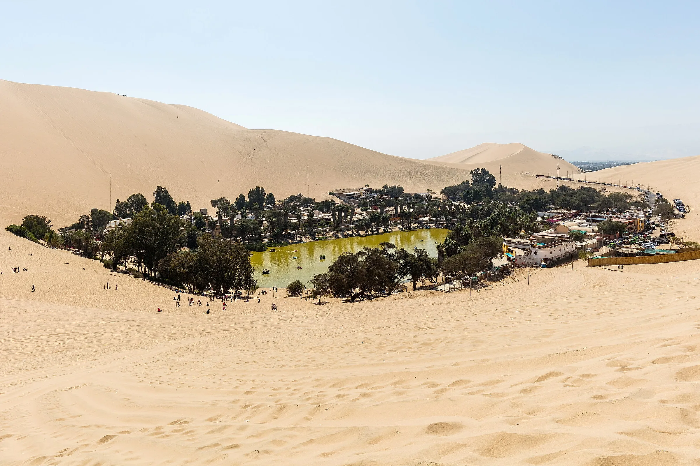
The oasis of Huacachina, Ica. Photo by Diego Delso, CC BY-SA 4.0, via Wikimedia Commons.
How it fits a Peru trip
The south coast is the natural way back to Lima after the Andes, or a short trip on its own before flying to Cusco. Our guide to the best places to visit in Peru shows where it sits in the whole route, and our Peru itinerary guide shows how many days it adds. For the trips we run, see our Peru tours.
Asked before booking
The questions we get on this
- Are the Nazca Lines worth visiting?
- Yes, if you combine them with the coast around them rather than making a single long day of it from Lima. On their own the lines are a short visit. With the Ballestas Islands at Paracas and the dunes of Huacachina on the same route, the south coast becomes two or three good days.
- How much does it cost to see the Nazca Lines?
- The viewpoints cost little; the flight is the expense. Peru's national tourism inventory, in a listing dated November 2022, gave an airport tax of S/ 30 and an air circuit fee of S/ 47 on top of the flight itself, with packages from US$70 to US$120. Fees change, so check them on the day.
- How far are the Nazca Lines from Lima?
- A little more than six hours by car, according to PromPerú: about four hours from Lima to Ica and about two more from Ica to Nasca. That is why we split the journey with nights at Paracas and Huacachina instead of doing it in one day.